
Every runway has a number painted in giant white digits at each end, and those numbers are not random. They are a direct readout of the compass heading the runway points toward. Once you know how to translate that number into a direction, you can make a confident guess about which end of the runway aircraft will use before you even arrive, and position yourself for a much better view.
This is one of the simplest and most useful tricks in plane spotting. It takes a few minutes to learn, works at virtually every airport in the world, and turns a random strip of asphalt into something you can actually read.
What Runway Numbers Actually Mean
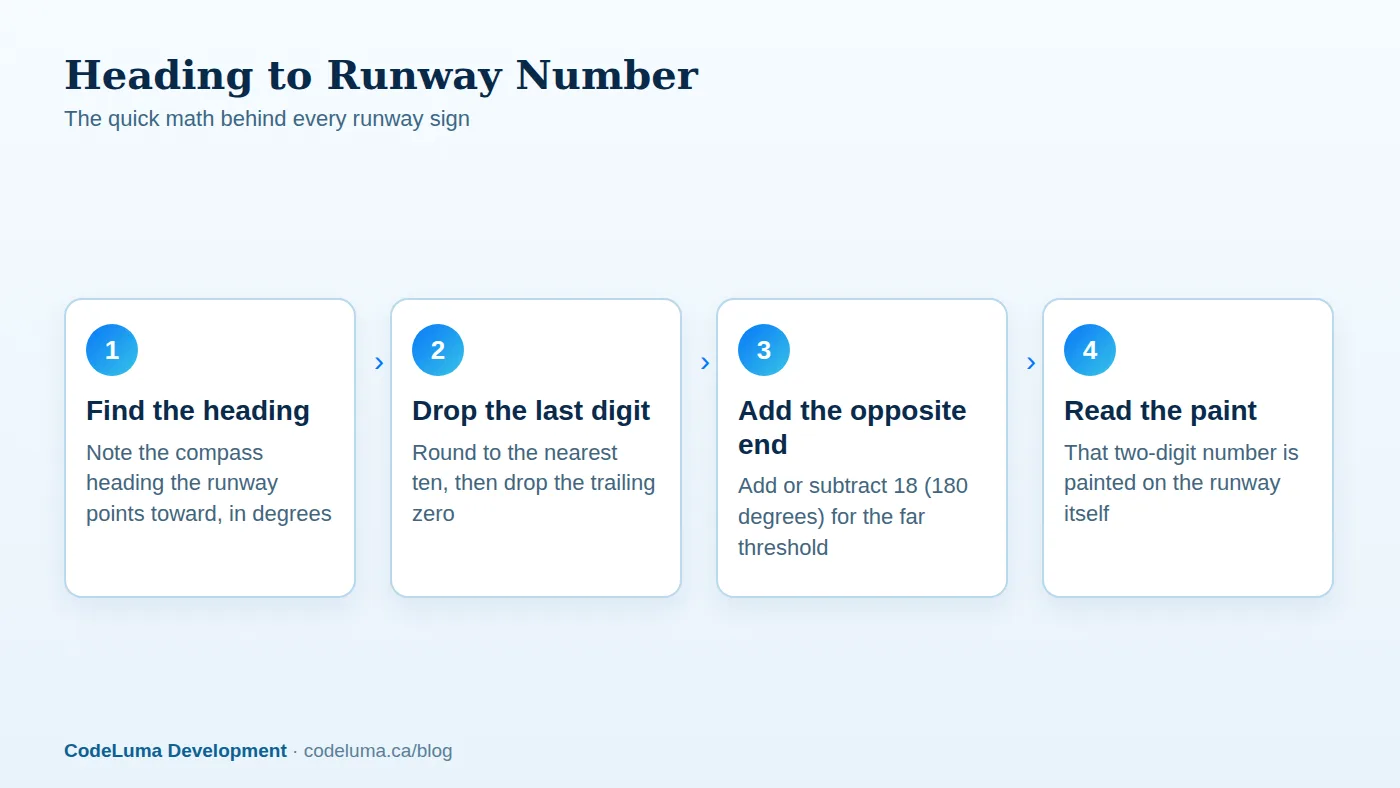
A runway number is simply its magnetic compass heading, rounded to the nearest ten degrees, with the final zero dropped. A runway numbered 09 points toward roughly 090 degrees, which is due east. A runway numbered 27 points toward 270 degrees, which is due west. Here is the key part: 09 and 27 are not two different runways. They are the two painted ends of the exact same strip of pavement, just read from opposite directions.

From Heading to Number: The Quick Math
To go from a compass heading to a runway number, divide by ten and round to the nearest whole number. A heading of 183 degrees becomes runway 18. A heading of 047 degrees becomes runway 05. To find the number on the opposite end of that same runway, add or subtract 18 (which represents 180 degrees, the reverse direction). Runway 18 becomes runway 36 on the other end. Runway 05 becomes runway 23.
Why 09 and 27 Are the Same Strip
New spotters sometimes assume a runway labeled 09 and one labeled 27 are separate runways somewhere else on the field. In reality, airports almost always print both numbers because aircraft can take off or land in either direction, depending on conditions. Which number is "active" at any given moment depends on which way the wind is blowing, not on the runway's shape or location.
Parallel Runways and the L, C, R Letters
Busy airports often build two or three runways side by side, pointing the same direction. Since they would otherwise share an identical number, each gets a letter suffix: L for left, C for center, and R for right, from the pilot's perspective on approach. You might see 27L and 27R at one end, which become 09R and 09L when read from the opposite direction, since left and right flip along with the heading.
Why Wind Decides Which End Is Active
Aircraft almost always take off and land facing into the wind whenever practical. A headwind shortens the ground roll needed to get airborne and gives pilots more control during landing, so airports choose the runway direction that points most directly into the prevailing wind at that moment. This is why the same runway can be "09" in the morning and "27" in the afternoon if the wind shifts, and it is the single biggest clue for predicting which end will be busy.
How to Watch for Wind Clues on the Ground
You do not need specialized equipment to estimate wind direction. Windsocks are mounted at most airports and are visible from public roads and terminal windows. Flags, smoke, and even the direction trees are leaning can help in a pinch. Local weather reports also list current wind direction, and matching that number to the nearest runway heading gives you a strong hint about which approach end will see traffic.
Using SmartMarty Sky to Confirm the Picture
Estimating from wind alone gets you close, but live aircraft positions remove the guesswork entirely. Open your free SmartMarty Sky account and switch to Map View to watch inbound flights as they line up on final approach near your chosen airport. Because Map View is a zoomable world map with no fixed distance limit, you can follow traffic patterns well beyond the immediate airport grounds, while Sky View gives you a radar-style look at everything within 200 kilometres if you are already on site with your phone pointed skyward.
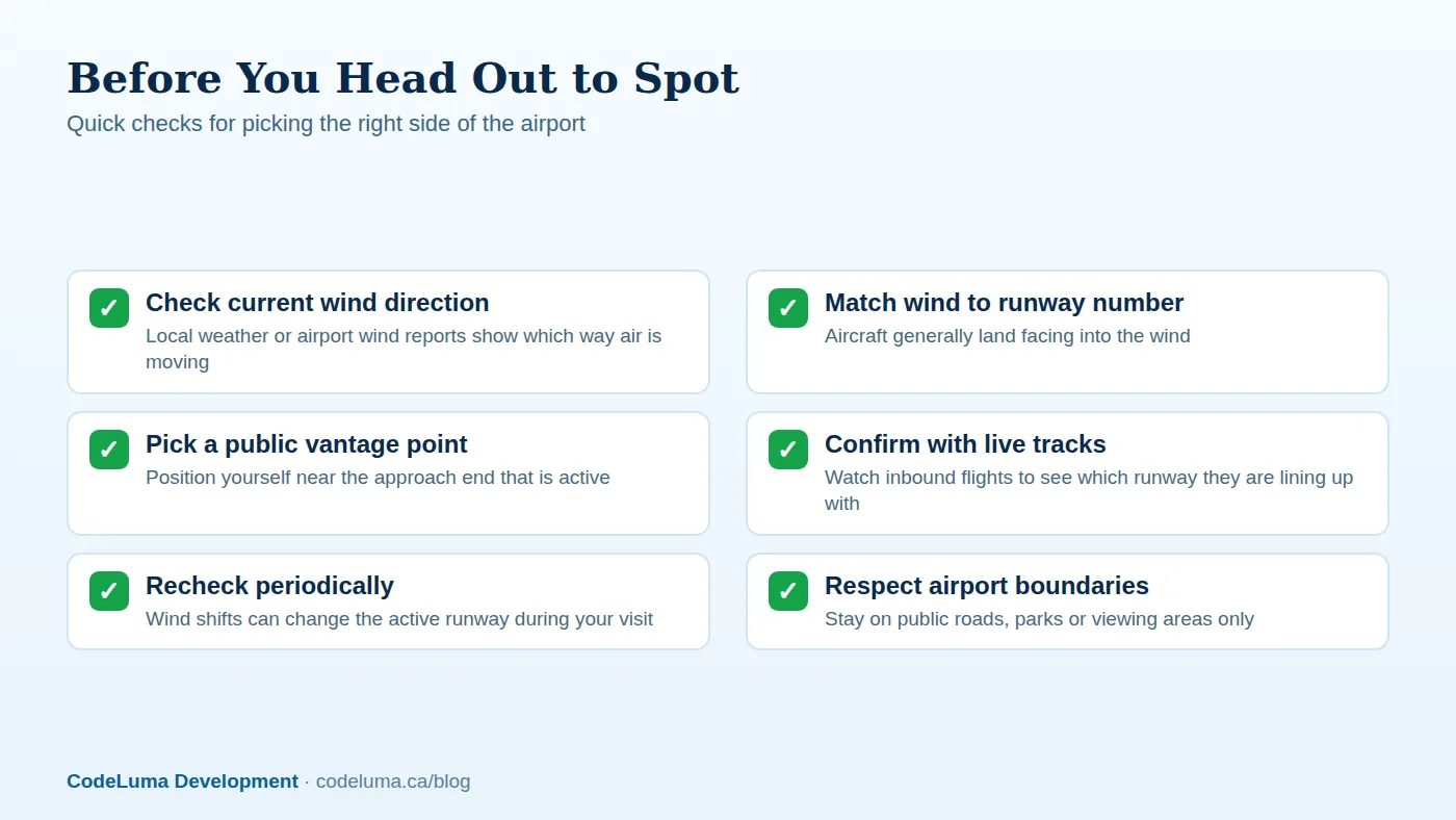
Watching a few animated tracks bend onto the same heading confirms which runway end is genuinely active, which matters because wind can shift during the time it takes you to drive over. Pair this with tips on picking a good vantage point and you can set up well before the next arrival rolls in.

A Step-by-Step Approach for Any Airport
Here is a simple routine to follow at an unfamiliar airport:
- Look up the runway layout and numbers, often listed on an airport directory page.
- Check current wind direction from a local weather source.
- Match the wind to the closest runway heading to guess the active end.
- Confirm with live inbound tracks before committing to a vantage point.
- Choose public parking, a road shoulder, or a designated viewing area near that end.
Common Mistakes Spotters Make
A few errors trip up even experienced spotters. One is assuming the runway number never changes, when in fact airports actively switch ends as wind shifts throughout the day. Another is confusing the two numbers on a single runway for two separate runways, leading someone to search the wrong part of the field entirely. A third is ignoring crosswinds: pilots do not always land dead into the wind, since a moderate crosswind is often acceptable and other factors like noise abatement routes or airspace design can override the simple wind rule. Treat the wind method as a strong starting guess, not an absolute.
A Few More Things Worth Knowing
Runway numbers are based on magnetic headings, which drift slowly over years as the Earth's magnetic field shifts. This is why airports occasionally repaint a runway with a new number even though the physical pavement never moved. It is a small reminder that these numbers describe direction, not identity. It is also worth remembering that noise abatement procedures, obstacles, or air traffic control decisions can mean the "calm wind" or less obvious runway gets used instead of the one you expected, which is another reason a live confirmation beats a guess.
Wrap-up
Reading runway numbers turns a guessing game into an educated prediction. Learn the heading-to-number math, watch for wind clues, and remember that every runway has two faces depending on the day. For the final confirmation, nothing beats watching real aircraft tracks bend onto final approach. If you want to see that live before you even step outside, install SmartMarty Sky on your phone, browser, or desktop and start matching the numbers on the ground to the traffic in the sky.
See what is flying overhead
Once you've guessed which runway end is active, confirm it live. Open SmartMarty Sky's Sky View or Map View to watch aircraft tracks bend onto final approach in real time, no guessing required. New accounts get 100% free access to try it for yourself.
- Airport directory - medium and large airports worldwide, browsable by country.
- Create your free account - SmartMarty Sky is 100% free, with no ads and no credit card.
- Install SmartMarty Sky - Android, iPhone and iPad web app, Windows, Linux and browser options.
- Blog - more aviation stories and guides.
Look up and know. SmartMarty Sky shows live nearby aircraft on a radar-style Sky View and a worldwide map. Every feature is 100% free — no ads and no credit card. It is an enthusiast information tool, not a navigation or safety system.