
Every plane-spotting habit starts with the same small moment: something loud or low or oddly shaped crosses overhead, and you think, what was that, and where is it going? SmartMarty Sky exists because that question deserves a fast, honest answer, not a login wall or a spreadsheet of raw data. This is the story of why we built it, what it actually does, and what it was never meant to be.
Where the Idea Started
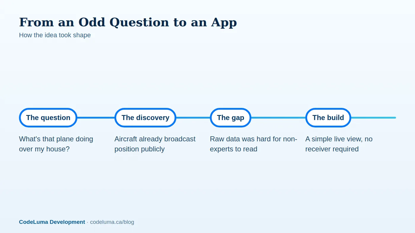
The idea didn't begin with a business plan. It began with the ordinary experience of standing outside, hearing an aircraft, and having no easy way to find out what it was. Meanwhile, a lot of that information was already public. Modern aircraft continuously broadcast identity, position, altitude and speed using a system most people have never heard of, even though the signals fly over their heads daily. The gap wasn't a lack of data. It was a lack of a simple way for an ordinary person to see it.

What Public Broadcasts Actually Are
Most aircraft flying today carry equipment that transmits their identity and position openly, a technology explained in more detail in our plain-language guide to ADS-B. These broadcasts were designed for safety and traffic coordination between aircraft and controllers, not for entertainment. But because the signals are public, anyone with the right receiver, or access to a network that collects them, can see the same identity, altitude and track information that shows up on an air traffic display, just without the tools controllers use to actually manage traffic.
From Raw Signals to a Live View
Turning that raw information into something readable is the actual engineering problem. A stream of coordinates and identifiers means very little on its own. It has to be matched against aircraft and route records, updated continuously, and laid out visually so a glance tells you what a paragraph of numbers used to. That's the work behind SmartMarty Sky: taking public broadcast data and presenting it as a live map or radar-style view, with searchable callsigns, registrations and aircraft identities, so the person looking doesn't need to understand the underlying signal to get a useful answer.
Sky View vs. Map View: Two Ways to Look Up
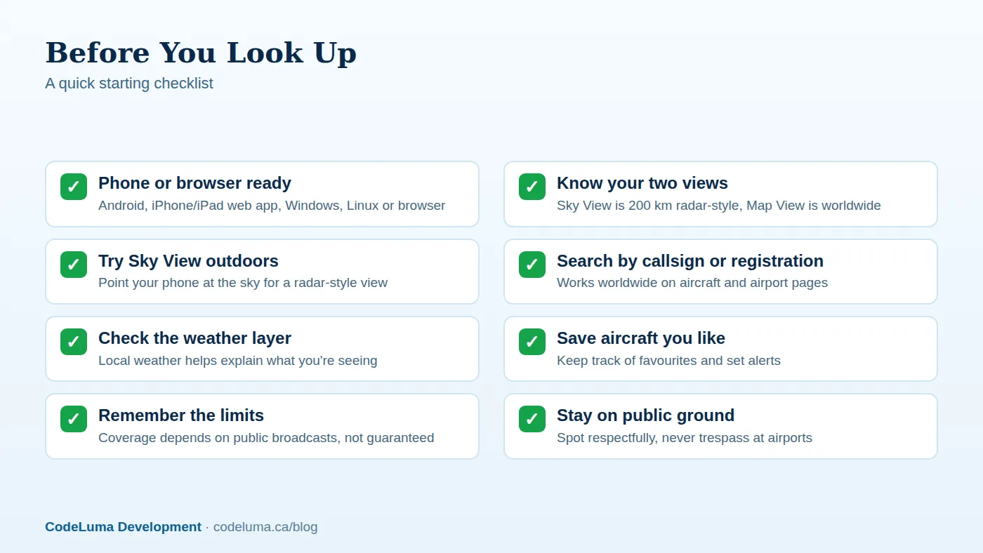
We built two distinct views because "what's flying near me" and "what's flying anywhere" are different questions. SmartMarty Sky offers a radar-style Sky View that shows aircraft within a fixed 200 kilometres of you, which is ideal for pointing your phone at the actual sky and seeing what's overhead right now. Map View, by contrast, is a zoomable world map with no distance limit, better suited to tracking a specific flight across an ocean or browsing traffic somewhere you'll never physically stand. Both draw on the same idea: live, public information should be easy to see, not locked behind a specialist's toolkit.
What SmartMarty Sky Is Not
It's worth being direct about this. SmartMarty Sky is an information and enthusiast tool. It is not an aviation safety, navigation or air-traffic tool, and it should never be treated as one for making real decisions about flying or airspace. Coverage, aircraft details and routes depend on whatever public broadcasts and verified records are available at the time, so gaps happen and completeness is never guaranteed. The app is meant to satisfy curiosity and support hobbyists, not to replace the professional systems that actually keep aircraft safely separated.
Getting Started in a Few Steps
Trying it out doesn't require any hardware. Here's the shortest path from curious to informed:
- Create an account and create your free account — every feature is 100% free.
- Open Sky View outdoors and hold your phone up like a compass toward the aircraft you can hear or see.
- Switch to Map View to follow a specific flight, or to browse traffic somewhere else in the world entirely.
- Search by callsign, registration or ICAO identity when you already know what you're looking for.
- Save aircraft you find interesting and set an alert so you don't have to keep checking manually.
Public airport and aircraft pages can be browsed without a paid membership, so there's no obligation just to look something up once.

Common Mistakes New Users Make
A few habits trip people up early on. Expecting perfect, uninterrupted coverage everywhere is the most common one; broadcast availability varies by location and aircraft equipment, so occasional gaps are normal rather than a sign something's broken. Another is confusing Sky View's fixed 200-kilometre radar-style range with Map View's unlimited zoom, and then wondering why a distant flight isn't showing up in the wrong view. People also sometimes assume they need a personal receiver or an API key just to look something up, when normal use requires neither. Finally, and importantly, treating registration lookups as a way to identify or track private individuals crosses a line we deliberately avoid; the focus stays on aircraft and public flight activity, not on people.
Why This Matters Beyond Curiosity
Plane spotting has always rewarded patience and a good vantage point, something we've written about in our guide to finding a good spotting spot. But live tracking adds something spotting alone can't: context. Knowing a distant contrail belongs to a specific route, or that the aircraft rattling your windows is a particular type on final approach, turns a passing noise into a small, satisfying piece of understanding. That's the same instinct behind why carrying live tracking in your pocket is worth it in the first place: the sky is full of information that used to belong only to specialists, and making it legible to everyone else felt like the right thing to build.
What's Next for Curious Sky Watchers
None of this requires becoming a technical enthusiast. Most people will never touch a receiver, and that's by design, since normal use of SmartMarty Sky needs neither a personal receiver nor an API key. For the smaller group who want to go further, an optional receiver setup guide exists for those who want to contribute their own local coverage. Everyone else can keep it simple: open the app, look up, and let the live view do the translating.
Wrap-Up
We built SmartMarty Sky because a public, honest signal was sitting in the sky and deserved an easy way to be seen. It won't tell you everything, and it isn't meant to guide anything but your own curiosity. But the next time something crosses overhead and you wonder what it was, that answer should take seconds, not detective work.
See what is flying overhead
Curious what's flying over your street right now? Start SmartMarty Sky's 100% free access and point your phone at the sky, or open Map View to see the world from your desk. No receiver or account setup beyond a quick sign-up is needed to look.
- Create your free account - SmartMarty Sky is 100% free, with no ads and no credit card.
- Install SmartMarty Sky - Android, iPhone and iPad web app, Windows, Linux and browser options.
- Optional receiver guide - advanced receiver setup for enthusiasts.
- Blog - more aviation stories and guides.
Look up and know. SmartMarty Sky shows live nearby aircraft on a radar-style Sky View and a worldwide map. Every feature is 100% free — no ads and no credit card. It is an enthusiast information tool, not a navigation or safety system.