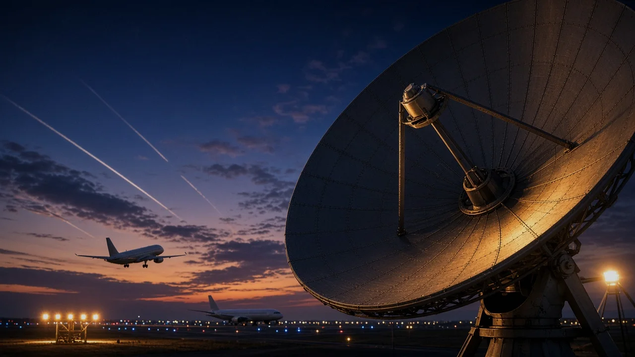
Every dot that glides across a radar-style screen has a story behind it, and that story stretches back further than most plane spotters realize. The way we track aircraft today, by reading public broadcasts from the aircraft itself, is the result of a decades-long shift from bulky ground stations to self-reporting signals. Understanding that history makes it much easier to understand exactly what you're looking at when you open Sky View or Map View in SmartMarty Sky.
How Radar First Put Aircraft on a Screen
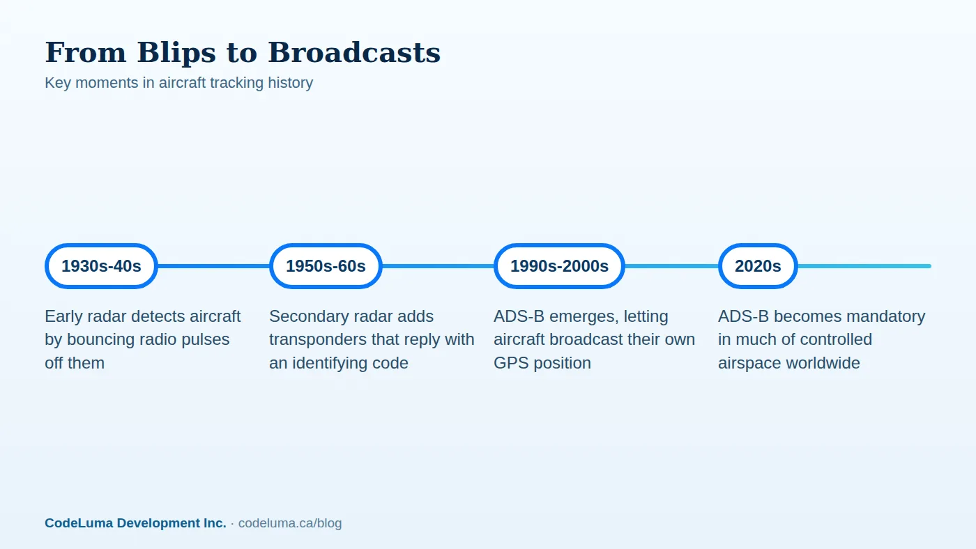
Radar, short for radio detection and ranging, matured rapidly during the Second World War as a way to detect approaching aircraft at a distance. The basic idea is simple: a ground station sends out a pulse of radio energy, and when that pulse bounces off a metal aircraft, a receiver picks up the echo. By measuring how long the echo takes to return and from which direction, operators could plot an aircraft's rough position on a screen. This is now called primary radar, and it works whether or not the aircraft is cooperating, since it only needs something solid enough to reflect a signal.
Secondary Radar Adds a Voice to the Blip
Primary radar could show that something was in the sky, but not what it was. Secondary surveillance radar, developed in the postwar decades and still used by air traffic control today, solved this by asking aircraft to answer. A ground interrogator sends a signal, and a device on board called a transponder replies with an identifying code and altitude. That reply is what let a plain blip become a labeled target on a controller's screen, with an assigned four-digit squawk code tying it to a specific flight.
The Real Limits of Ground-Based Radar
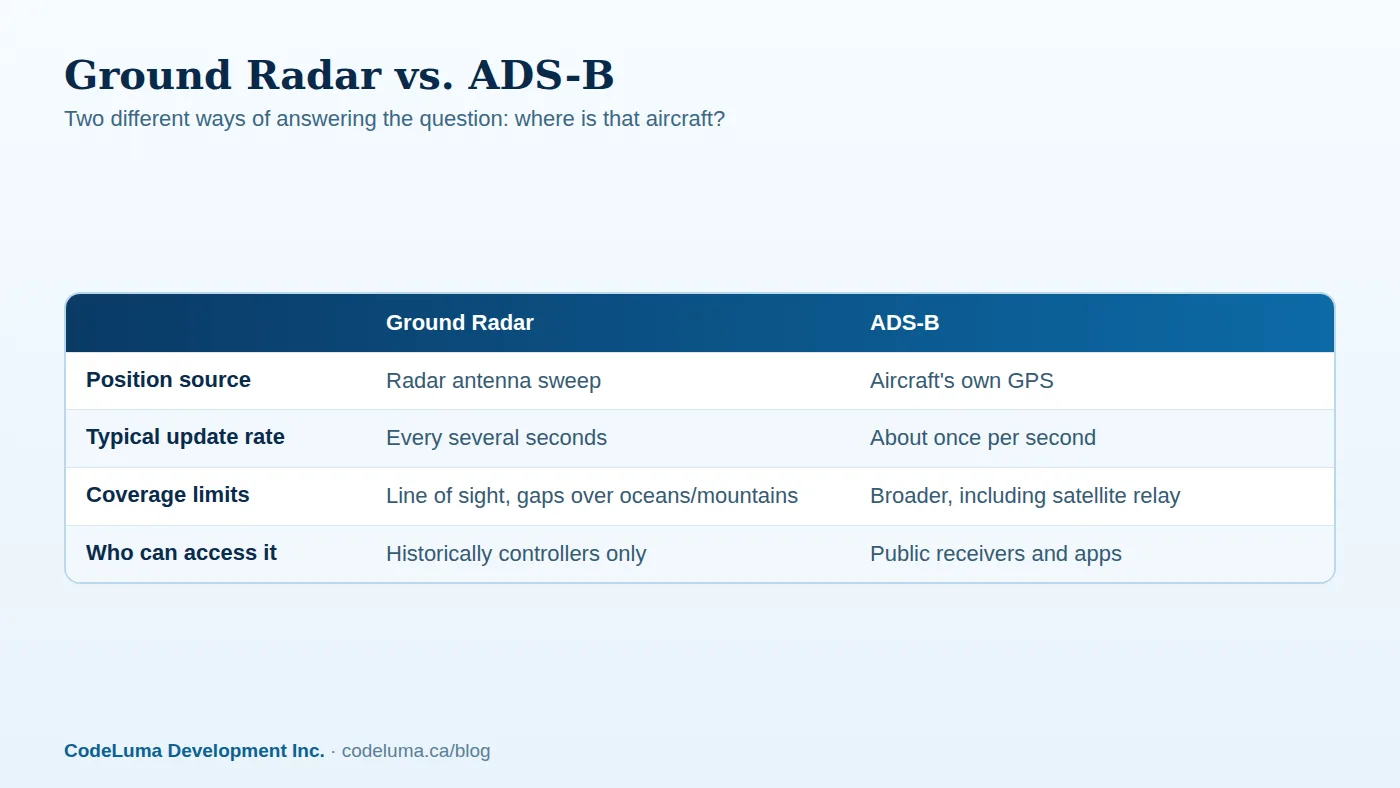
Radar transformed air traffic control, but it was never perfect. Both primary and secondary radar depend on line of sight, so mountains, the curvature of the Earth, and long distances over oceans create coverage gaps. Radar stations are expensive to build and maintain, and most only update an aircraft's position every several seconds rather than continuously. Oceanic and remote airspace, in particular, relied for decades on pilot position reports rather than direct radar coverage, which left wide stretches of sky effectively unmonitored in real time.
Enter ADS-B: Aircraft That Report Themselves
Automatic Dependent Surveillance-Broadcast, or ADS-B, flips the old model on its head. Instead of a ground station reaching out to interrogate an aircraft, the aircraft determines its own position using satellite navigation and broadcasts it continuously, roughly once per second, along with altitude, speed, and identity. Any receiver within range, whether operated by an air navigation authority or a hobbyist, can pick up that signal. For a deeper look at exactly what's packed into one of these broadcasts, our guide to ADS-B messages breaks it down field by field.
From Military Roots to Public Information
The underlying concept of aircraft self-reporting position has roots going back to earlier automatic dependent surveillance systems, but ADS-B as we know it took shape through the 1990s and 2000s and became mandatory in much of the world's controlled airspace through the 2010s and 2020s. Because ADS-B is broadcast openly on standard frequencies rather than encrypted or restricted, it quietly became one of aviation's most public data sources. That openness is the reason enthusiast tracking became possible at all, a shift explained in more depth in how live aircraft tracking actually works.
What This Shift Changed for Plane Spotters
Before public ADS-B data, knowing what was overhead meant either working in aviation, owning specialized and expensive receiving equipment, or simply guessing from shape and sound. The broadcast era changed that. Today, worldwide networks of receivers collect these signals and make them searchable by the public, which is exactly what powers SmartMarty Sky's Sky View and Map View. You don't need to operate your own antenna; you need a phone and a view of, or interest in, the sky.
Reading Sky View and Map View With This History in Mind
Knowing where this data comes from changes how you read it. Sky View shows a radar-style live picture of aircraft within a fixed 200 kilometres of you, echoing the original purpose of a radar scope but built entirely from broadcast data rather than a spinning antenna. Map View drops the distance limit entirely, letting you follow an aircraft's animated path across a zoomable world map in a way no single ground radar station ever could. When you search by callsign, registration, or ICAO identity, you're querying the same kind of identity information that secondary radar transponders first introduced decades ago.
A Simple Checklist for Getting Started
- Open Sky View outdoors or near a window for the clearest sense of what's actually overhead.
- Switch to Map View when you want to follow a specific flight beyond the 200 kilometre radius.
- Search by callsign or registration if you already know what you're looking for.
- Check the aircraft's public page for available details, remembering that information depends on what's broadcast and verified.
- Save aircraft or set alerts for types or routes you want to catch again.
- Browse the airport directory to see what regularly moves through a specific airport.
Common Mistakes to Avoid
New trackers often expect radar-style completeness, assuming every aircraft in the sky must appear on screen. In reality, coverage depends on available public broadcasts, and some aircraft, airspaces, or moments may simply not be captured. Another common mistake is treating any tracking app, including SmartMarty Sky, as a navigation or safety tool. It isn't, and it was never meant to be. It's an information and enthusiast tool for understanding and enjoying what's flying, not a substitute for air traffic control. Finally, resist the urge to speculate about who owns a specific private aircraft; the data shows identity and position, not intent.
Why the History Still Matters Today
The move from radar scopes to ADS-B broadcasts isn't just a technical footnote, it's the reason live, worldwide aircraft tracking exists for ordinary people at all. Ground radar was closed, expensive, and limited by geography. Public broadcast data is comparatively open, inexpensive to receive, and far less constrained by terrain. That shift is what makes it possible to stand in a backyard, aim a phone skyward, and understand exactly what's passing overhead, or to trace a flight from takeoff to landing on the other side of the planet.
Wrapping Up
From wartime radio pulses to transponder codes to continuous satellite-based broadcasts, aircraft tracking has steadily become more open and more detailed. That evolution is exactly what lets SmartMarty Sky turn public ADS-B data into a radar-style view in your pocket. If you want to see it for yourself, install SmartMarty Sky and start exploring the sky above you today.
See what is flying overhead
Curious how the dots you see in Sky View connect back to decades of radar history? Open SmartMarty Sky and watch live ADS-B broadcasts turn into real aircraft overhead, no personal receiver required, and try it free with the 100% free access.
- Create your free account - SmartMarty Sky is 100% free, with no ads and no credit card.
- Install SmartMarty Sky - Android, iPhone and iPad web app, Windows, Linux and browser options.
- Airport directory - medium and large airports worldwide, browsable by country.
- Aviation news - sourced aviation reports and searchable archives.
Look up and know. SmartMarty Sky shows live nearby aircraft on a radar-style Sky View and a worldwide map. Every feature is 100% free — no ads and no credit card. It is an enthusiast information tool, not a navigation or safety system.